The Daily Tofu

A place for art, culture, history, and creation

Discovery

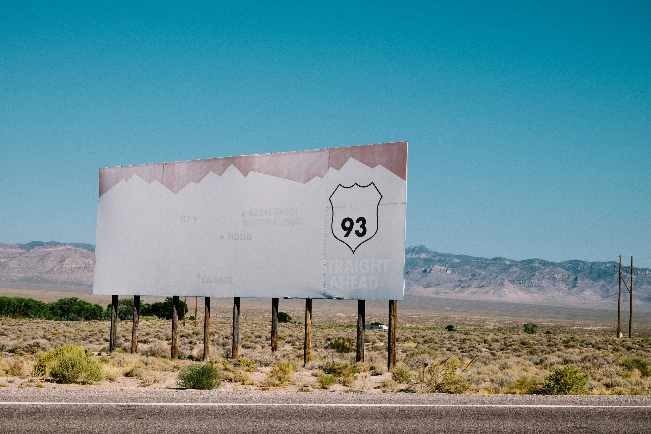
Travel: The Great Nevada Road Trip - Day 1 - The Road to Great Basin

Travel, Photography, Culture, History, NatureTrey TakahashiComment
US-93 Sign and all the destinations long faded and abandoned. 

US-93 Sign and all the destinations long faded and abandoned. 

Setting Off

The sun breaking over I-15 heading North

The sun breaking over I-15 heading North

All the bags were packed and resting by the door early in the morning before sun broke over the horizon. Setting off as the sun broke was our best plan if we wanted to hit all of our destinations along the way, passing through several towns and parks along the way such as Pahranagat, Alamo, Caliente, Cathedral Gorge, and our final destination being Great Basin National Park. Our route would take us up US 93, around Mount Wilson Scenic Byway, and up on a short stint of Highway 50 taking us the town of Baker and the gateway to Great Basin National Park. So, at 5:30am we hopped in Celeste’s blue Ford Explorer Sportrac to push on our long drive north.

Celeste, excited for the drive ahead.

Celeste, excited for the drive ahead.

A small interchange and a truck stop, easy to miss on the drive.

A small interchange and a truck stop, easy to miss on the drive.

In order to get to US-93 we had to drive through the whole of the Las Vegas metro area up I-15 with the sun in our eyes. Leaving now was a symbolic gesture for us. The sun was breaking over a new horizon, shining light into a new part of me. Now, I was setting off on a new adventure to see the heartland of the state I called home, but was also gearing up for a path of self-discovery and exploration on someone that I knew I always could be deep down inside. Watching the golden sun rise over the desert was a beautiful site, an awaking appropriate for a new start and a drive to push forward. For Celeste this would mark her first journey through every county in Nevada, a place full of various environments and people with a heart of gold (or silver)—and I was proud to be able to guide her through this place and show her just what Nevada is. Before long we hit the interchange to head off onto US-93 heading north, and with the turn off and passing a truck stop our journey official began now there was no turning back.

US-93 runs straight for miles with only a few turns in between.

US-93 runs straight for miles with only a few turns in between.

US-93 cuts straight through the eastern part of Nevada running north-south up through Idaho and beyond with very few curves along the way. Much like the famous Highway 50, this long stretch of road passes through much of the arid parts of the state with long stretches of abandonment along the way. Passing through sweeping arid deserts and large parts of the Great Basin, the land here is hot and void of much activity. Here only a few shrubs in the form of sagebrush and cactus exist with only trees sprouting up in the mountains and occasional meadows along the way. Aside from the noise of infrequent motorists, this land is quiet and isolated; throwing you into the thralls of intimate thoughts as the highways stretches off into the horizon line leaving you with the image of a mirage. Its easy to lose yourself along this great length of roadway; drifting off into a daze is a frequent problem when driving these stretches of road. With time and a few stops along the way, it suddenly becomes less monotonous and a much more rewarding experience.

Pahranagat and Abandonment

Our first stop was at Pahranagat National Wildlife Refuge, a small lake protected by the Department of the Interior for nesting of regional birds in the dry basin. By now the sun was already beginning to crest and we were both in desperate need of stretching our legs after just over an hour of driving. We pulled up and walked through the meadows, seeing birds and insects in a meadow sprawling with life. There were a few cars there too, but there was a complete absence of people, just us and the sound of the wind slowly blowing through tall grass and the trees surrounding the basin. We sat in silence for a while, stuck in a moment of inner reflection before taking a few photos and then setting back on the road. We had a long drive still, lots more stops, and a booked tour at Great Basin National Park at 4pm.

We drove through the small towns of Alamo, Ash Springs, and Crystal Springs, looking at abandoned buildings and a few hubs of life. Each of these small hubs began to shine a light into what Nevada is all about—unique spots where the Wild West thrived but never really died. Each of these ‘ghost towns’ containing a small but lively community calling them home. Still empty shells of a glorious past of railway construction and mine booms, but nonetheless representations of the strong and rich heritage of the great Silver State and her importance in settling and ultimately conquering the west.

Abandoned signs from a business long shuttered.

Abandoned signs from a business long shuttered.

Caliente and Kershaw-Ryan State Park

Caliente was our next stop, a small town whose name in Spanish directly translates to “hot,” appropriately named due to the hot springs surrounding the area. Now only a small town with just over 1,000 people, it used to be a thriving railroad town that was built up as a destination stop along the Union Pacific railroad. Much of the downtown was abandoned, with boarded up shops and businesses that had long since died, but even on a Sunday, the community was still gathering for church services and family gatherings. The largest defining feature of the town that stands out above all else in the old Spanish railroad depot built in 1923 that now is home to all of the major town services including city hall, public library, local museum, a small church, art gallery, and a mental health clinic. We greeted several people outside of the great white building as they headed into church services. 

The Spanish railroad depot built in 1923 is now the central hub of town.

The Spanish railroad depot built in 1923 is now the central hub of town.

 A train passes by Caliente without so much as a stop, only halting traffic for a brief moment.

 A train passes by Caliente without so much as a stop, only halting traffic for a brief moment.

This town like many others along this route slowly died with with the urbanization of major cities and the modernization of the railroad. Where this used to once be a stop along the way for passengers and crew to relax and refuel boilers, it is now simply a small hub where trains pass right through with diesel engines that can run far longer and more reliably than any steam engine ever could. With once a population over 5,000 the town died, and as we waited at a light and watch a modern train hauling cargo along the great Union Pacific Railroad it was clear that the need for this town has long passed, 

One of the old downtown shopping areas of Caliente

One of the old downtown shopping areas of Caliente

Buildings from the original ranch site and those built by the CCC are still present.

Buildings from the original ranch site and those built by the CCC are still present.

Beautiful gardens of flowers in full bloom decorate the landscape.

Beautiful gardens of flowers in full bloom decorate the landscape.

 As we drove around the town we stopped off at Kershaw-Ryan State Park which was marked on our detailed Nevada map, small but just a few miles off of US-93 it seemed like a great destination to check out before we left the area entirely. We instantly became amazed with this little hub, coming into it with complete ignorance of its very existence. The area was once a small ranch that looks like a blossoming oasis in the arid landscape. Founded in 1873 and built up by the Civilian Conservation Corps (CCC) during the Great Depression it stands as one of the older Nevada state parks. We walked through well maintained flower beds and along a wonderful path that took us through lush greenery and old buildings that had fell into ruin throughout the years. This small little place was a wonderfully relaxing place to spend a day, evening, or just a few minutes to explore and escape. A young couple came up too and were playing with their small child in the swimming pool that glowed a florescent blue, and coupled with the birds singing their songs, this small oasis seemed like the perfect escape for anyone looking to take a load off, if even just for a minute.

Lush green paths are carved out creating an awaises in the arid desert

Lush green paths are carved out creating an awaises in the arid desert

Cathedral Gorge State Park

 A look into the twisting canyons of the Cathedral Gorge formations

 A look into the twisting canyons of the Cathedral Gorge formations

Caused by volcanic ash mixed with other regional sediment, this unique clay erodes with the rain leaving breathtaking structures behind.

Caused by volcanic ash mixed with other regional sediment, this unique clay erodes with the rain leaving breathtaking structures behind.

After leaving the great small hubs of Caliente and the much needed stroll through Kershaw-Ryan, we continued our journey on US-93 to Cathedral Gorge State Park and Pioche where we had agreed to stop for lunch before continuing on the final leg of our journey. By now, it was just before noon and we were still making excellent time on our drive. Both of us were full of anticipation for Cathedral Gorge. It is a state park that I hadn’t been to in such a long time that I had forgotten much of its beauty. I have often heard people call the park a place almost rivaling parts of Zion National Park, just on a smaller scale. Having been sold on the unique formations that exist there and knowing the other beauty of Nevada state parks such as the Valley of Fire, we headed into the park to see the formations up close for ourselves.

As we entered from a distance, we could already see the strange formations along a large plateau. As if the walls of the plateau were simply melting away, spires of a clay like substance stretched up into the sky. The formations stretch on for miles and in many parts look like they cut right into the hillside. We pulled up to a parking spot and had to get a closer look into the melting Earth, stepping inside what appeared to look almost like a cave, it felt like we were quickly heading onto a science fiction film set on a very distant alien planet. The formations twisted and turned, with the sun only highlighting various portions of the path, the earth was soft to the touch, leaving a trace of silt on our hands and clothing brushing past—it was if the walls were made up of clay, long hardened earthenware that had never been fired, just dried up in the hot sun above. We had never seen anything quite like this, and it was staggering in its beauty. There are many places in Utah that offer unique formations of rock that are famous monuments of natural beauty, such as the (famous) rock formations of Bryce Canyon, but here there was something truly magnificent that I had never seen before.

A close-up of the unique spires and the earth build up. Alien in their look and texture.

A close-up of the unique spires and the earth build up. Alien in their look and texture.

A view looking upward from the spires of clay.

A view looking upward from the spires of clay.

The cause for these formations comes from a combination of erosion, water formations, and interestingly enough, volcanic activity in the area. As ash from active volcanoes in the area settled down millions of years ago, it created a unique clay like substance that collected up into piles hundreds of feet high. Along with mountainous changes and the creation of the valley, the area filled up a lake which later dried up, leaving with it a unique clay like substance that stands today, continually eroded away by rainfall and dried by the intense sun. We were fascinated by this place not just for the geologic formations, but also for the historic buildings that remained within. Just as we saw with the Kershaw-Ryan state park, the CCC too had built structures here to house people travelling through and provide refuge in this harsh landscape. Many of those structures are still standing. We stopped to rest under the old wooden shade structure before continuing onward to the historic center of Lincoln County, Pioche, NV.


Pioche

The old mine bucket tram still stands with cables stretching over parts of the town. 

The old mine bucket tram still stands with cables stretching over parts of the town. 

Just a few miles ahead, the small town of Pioche rests in the center of Lincoln County, Nevada. Acting as its largest city, and at one point the largest destination on the Eastern part of Nevada. Standing long before even the great city of Las Vegas was in her infancy. Both a major railroad destination and an even larger mine town, this town has become an infamous ghost town along US-93, showing just how far a town can go into decline. The main highway cuts right through the center of town, leading you down the original downtown district where the local museum and historic buildings still sit. We parked the truck, gathered our gear for exploring the town, and began to walk toward the museum.

Old mining buildings like this one still stand. Though long abandoned, wooden structures like these are historic landmarks for ghost towns across Nevada.

Old mining buildings like this one still stand. Though long abandoned, wooden structures like these are historic landmarks for ghost towns across Nevada.

A look at the downtown strip, as a man who grew up in town explores his roots.

A look at the downtown strip, as a man who grew up in town explores his roots.

Inside we met a nice retired fellow who was jubilated to see fresh faces walking into the museum. Growing up in Chicago, as he said, he eventually retired to Pioche to live in a quiet and peaceful community away from it all, “You’re either the young rif-raf or a retiree” he stated in his description of the town, and in his way he was correct. Nevada is unique in that many of the small ghost towns in decline are kept alive by passionate retirees who often return to their hometown to keep the place alive in the small ways they can, but there are still working families and young children who are stuck with not much to do aside working on the ranches and mines in the areas—causing slipping graduation rates and unfortunately an increased use of substance abuse in rural Nevada.

Closed and abandoned since a roof collapse in the early 2000s, the Gem Theater once showed films for over 100 years since its original construction in the late 1800s.

Closed and abandoned since a roof collapse in the early 2000s, the Gem Theater once showed films for over 100 years since its original construction in the late 1800s.

Despite the sad decline, Pioche is still very much alive with people clamoring to restore the many historic sites that exist. We continued to walk down the main street to visit the historic Gem theater which had shuttered after losing part of her structure in a strong windstorm in the early 2000s. Next door however, was the town’s visitor center were we met another older volunteer, a retired school teacher from Southern Nevada, who was eager to show us around and give us a tour of the building. Unknown to us, we had stepped inside the historic Town Hall and Opera house. Built in 1873, the original building acted as both a general store and a town meeting haul for the booming mining community. Upstairs stands the Thompson Opera House, meeting the demand to bring culture to the mine community by demand of the womenfolk of the town.

Recently restored and rebuilt after an accident destroyed much of the Opera House, it still puts on many acts and shows throughout the year.

Recently restored and rebuilt after an accident destroyed much of the Opera House, it still puts on many acts and shows throughout the year.

The changing rooms remain largely unchanged from their original state.

The changing rooms remain largely unchanged from their original state.

The entire facility was small, but carried with it that unique charm of a the fine arts in the center of a working mine town. Recently restored with grant money and run by volunteers, the staff look at filling the building with acts from around the country to perform for the local community. Much like the small opera house in Amargosa Valley, this small theatre lives on with the love and support of the local community. Unfortunately, without the draw from tourists, it still struggled to maintain. Regardless, the entire building shows just how much the local people of Pioche want their town to succeed and be more than just a ghost town long forgotten in the books of history.

Recently renovated and open for just over a year Ghost Town Art & Coffee Co. is the go-to hub in town.

Recently renovated and open for just over a year Ghost Town Art & Coffee Co. is the go-to hub in town.

Still containing the original workbench to the side of the kitchen the interior gives a certain charm of the building's former history.

Still containing the original workbench to the side of the kitchen the interior gives a certain charm of the building's former history.

Both our newly acquainted locals both pointed us to a new burger and coffee joint that had recently opened up by a couple of local artists called Ghost Town Art & Coffee. Here we decided to grab ourselves lunch before hitting the road once more. The small eatery was built into an old 1800s workshop where the original wooden interior could be seen along with the workbenches that were in service until it was renovated and turned into a restaurant. Serving up fresh veggie patties and some wonderful iced tea, we chatted with them about the town and the people who pass through it. Their art decorated the walls, creating a spot for both tourist and local alike to stop by and grab a bite. Stopping by we had our same guide of the opera house getting lunch along with a gentleman and a young woman visiting the town again where he told everyone he had grown up. This is the charm that these ‘ghost towns’ have. There is a heart and soul here that never really dies. Despite the isolation, despite the remoteness, there are hard working people looking to keep the place alive.

Despite new and restored buildings, there are still many old abandoned structures from the mining days constructed in the 1800s.

Despite new and restored buildings, there are still many old abandoned structures from the mining days constructed in the 1800s.

The Mount Wilson Scenic Byway

Along the byway are beautiful sights of the mountains spanning across the Great Basin

Along the byway are beautiful sights of the mountains spanning across the Great Basin

Spring Valley State Park is beautiful in its own way, alge has taken over parts of the reservoir as it lacks many outlets.

Spring Valley State Park is beautiful in its own way, alge has taken over parts of the reservoir as it lacks many outlets.

Leaving Pioche we checked our maps with a few locals to make sure we were on track. We had a couple hours to get to Great Basin National Park in order to go on our tour of the Lehman cave systems. Eager to make it on time, we looked at our route with the Mount Wilson Scenic Byway and decided that there was plenty of time to make the drive and be at the caves before the tour started. The byway looked to start along NV-322 and cut along Echo Canyon and Spring Valley State Park, allowing us to see more the beauty of Nevada instead of just continuing along US-93 as we had been doing. With some advice from locals, a Nevada map, and no cell service we turned off onto NV-322 for our scenic drive.

The ranger station remains abandoned on a Sunday afternoon.

The ranger station remains abandoned on a Sunday afternoon.

The road passed through the two state parks which are both reservoirs used for nesting for local wildlife and also a place of recreation for locals of the surrounding towns, and it was at Spring Valley state park where the road suddenly turned to dirt and all signs stopped giving any helpful information. A little lost but not undetermined, we followed the signs to the ranger station on the road ahead hoping to get pointed in the right direction to ensure we were driving along the right road. Unfortunately, being a Sunday afternoon, the ranger station was not manned and we hand no choice to push on. We had driven a little too far to turn back, but we remained confident that we were on the right stretch of road. Still lost, I waved down the next car on the road to see if I could get some much needed information.

"No way you'll make it in time buddy..."

"No way you'll make it in time buddy..."

An older couple hauling an RV with their dog in the rear seat pulled off the side and rolled down their window. Missing a few teeth with a camouflage bandana on his head he said the words we dreaded to hear, “You’re a long way from US-93 buddy, you’re not going to make it to Great Basin by 4pm.” Recommending we turn back the way we came was the smartest idea, he told us that the byway cut through the top of the mountains ahead and the road was rough, narrow, and difficult to drive. On that note he had to head out and drove off ahead.

We weighed our options, if either way we weren’t going to make it, we could at least enjoy the drive over the mountain. The truck, while old and full of character, was equipped with four wheel drive and had tires good enough for an off-roading drive. With both of us in agreement, we pushed on into the mountains, passing our friendly RV guides and took off into the hills.

Cave tour aside, missing it meant seeing some spectacular views climbing up Mount Wilson.

Cave tour aside, missing it meant seeing some spectacular views climbing up Mount Wilson.

The road was rough, tight, and lacking signs but an adventure to traverse. I took the wheel for this leg of the journey, slipped on the four wheel drive, and accelerated up the mountains bending around the pass. With each turn the truck swerved out, drifting around corners while trying to hold tight with all four wheels. Maybe, we thought, maybe we just might make it if we push hard enough. In no time at all the road began to climb higher and higher with steep drop offs of thousands of feet on the sides as we climbed over Mount Wilson. Adrenaline rushing through my veins, I continued to push that blue pickup across the dirt, admittedly a bit too faster than I should have.

After over two hours of mountainous dirt roads and the new front breaks smoking from the heat, we made it over Mount Wilson and could see US-93 ahead. We missed our cave tour, that much we knew, but we took pride in the fact that while that part of the trip was now lost, we had just made up for it with an awesome mountain off-roading drive that filled the day with excitement and showed us another part of Nevada we probably would have never seen.

Great Basin National Park

Baker Creek is home to hikes and trails in a park that is bustling with life.

Baker Creek is home to hikes and trails in a park that is bustling with life.

We arrived in Great Basin around 5pm, and were greeted at the visitor center by a red-eyed ranger who looked to be in desperate need of sleep just as much as we did. He pointed out a couple of campsite locations that were available and told us that we better get rolling because the spots fill up fast, especially during the summer months. So we chose to head out to Baker Creek, a camp site not too far of a drive that was said to have a few spots left. Maps in hand and saying goodbye to our red-eyed ranger, we headed through the park and into the campsite.

The creek cuts through vegetation just near the campsite making the place the perfect place to relax and enjoy the evening.

The creek cuts through vegetation just near the campsite making the place the perfect place to relax and enjoy the evening.

Nestled along a gorgeous grey rocked cliff, Baker Creek cuts right through the center of the park and camping is available right along its shores under the cool foliage surrounding it. Crystal clear and cold the water trickled down the rocks leaving an always peaceful sound around the campsite. This small creek was the peaceful place where we would rest our heads for the night before making another long drive up north on a detour to Idaho, and we broke camp early for much needed rest.

There is a motto for Great Basin National Park that goes, “Half the park is after dark.” Due to the remoteness of the park in the great vastness of the Great Basin, the park is home to one of the clearest night skies in the country. We rested our heads and looked toward the night sky through the mesh of our tent (to fend off mosquitoes) to view the stars slowly shining in their brilliance as the sky darkened. Excited for the show, we stayed up late well past 11pm gazing in awe of it all… until the moon breached the mountains and blinded us with its brilliance. Glowing like an orb in the night sky, we decided it was then we should lay our heads in rest. Tomorrow would be an even longer drive, and have just as many memories to carry with it.